
Formal/Scientific Name: Oxbow Lake
Designations in other languages: Commonly referred to as ‘dead arm’ in other languages. In French it is bras mort .
Identification: “A curved lake formed at a former oxbow where the main stream of the river has cut across the narrow end and no longer flows around the loop of the bend.”
Cause/Method of Creation: The most common type of lake of fluvial [river] origin, oxbow lakes are the product of a series of geomorphological events, a cut-off meander created by a water source that is formed on a sedimentary floodplain located on a very slight gradient. To understand the creation of oxbow lakes, we need to explain the creation of meanders first.
Step 1: A stream or river on a
nearly-level plain would normally flow in a straight line, but the stream path becomes altered as physical obstructions (stones, boulders and bedrock outcroppings) modify the direction of the waters flow, causing eddies, whirlpools and variations in the water-flow rate from one side of the river to the other. This variation in the water speed causes the current to swing back and forth in the stream bed.
Step 2: Where the stream flow is strong at the sides, it begins to erode the bank away, carving out a curve or arc.
Simultaneously, on the opposite side of the stream, the water flow is slower, allowing sediments from upstream to settle, filling in one side of the former stream bed and creating a wedge-shaped sediment deposit called a point bar. So while one side of the streambed is eroding sideways and sending sediment downstream, the opposite side is building up with sediment from upstream. This process slowly relocates the stream bed across the flat plain and creates bends in the river called meanders.
Step 3: Once this erosion and deposition process begins it continues to carve the meander until the loops are so pronounced, they almost form a full circle. Before the circle becomes complete the area of land at the “ends” of the meander (where the point bar first formed and then was consequently eroded away) is now a thin bridge, called a meander neck, separating upstream and downstream points on the river.
Step 4: The thin meander neck is finally eroded away and the river, flowing straight, through the cut-off, leaves behind the old, curved route. More sediment deposits from upstream quickly separate the stream from the deserted meander and, with it’s moving water source depleted, the meander has become a U-shaped lake or pond, resembling an ox bow. Some oxbow lakes stay filled with water, fed by other water sources, and some become filled with sediment and plant material. These filled oxbows are called abandoned meanders or meander scars.
Step 5: As the stream wanders over the plain, it continuously forms, and abandons, more oxbow lakes. Aerial photographs (see Aerial View below) of very old meandering streams and rivers show the overlapping, crescent-shaped, soil patterns of abandoned meanders, sometimes quite far from the water source, which has migrated across the plain, obliterating the older abandoned meanders formed long ago.
 |
| Step 1 |
nearly-level plain would normally flow in a straight line, but the stream path becomes altered as physical obstructions (stones, boulders and bedrock outcroppings) modify the direction of the waters flow, causing eddies, whirlpools and variations in the water-flow rate from one side of the river to the other. This variation in the water speed causes the current to swing back and forth in the stream bed.
 |
| Step 2 |
Simultaneously, on the opposite side of the stream, the water flow is slower, allowing sediments from upstream to settle, filling in one side of the former stream bed and creating a wedge-shaped sediment deposit called a point bar. So while one side of the streambed is eroding sideways and sending sediment downstream, the opposite side is building up with sediment from upstream. This process slowly relocates the stream bed across the flat plain and creates bends in the river called meanders.
 | |
| Step 3 |
Step 3: Once this erosion and deposition process begins it continues to carve the meander until the loops are so pronounced, they almost form a full circle. Before the circle becomes complete the area of land at the “ends” of the meander (where the point bar first formed and then was consequently eroded away) is now a thin bridge, called a meander neck, separating upstream and downstream points on the river.
 |
| Step 4 |
Step 5: As the stream wanders over the plain, it continuously forms, and abandons, more oxbow lakes. Aerial photographs (see Aerial View below) of very old meandering streams and rivers show the overlapping, crescent-shaped, soil patterns of abandoned meanders, sometimes quite far from the water source, which has migrated across the plain, obliterating the older abandoned meanders formed long ago.
Formation Table: Oxbows are…
Exogenic forms (on or near the earths surface), created by
Erosion–via the Transportation Force of fluid (water) and
via the Deposition Means of the physical deposit of sediment.
Variations: Meander scars – former oxbow lakes filled with sediment and organic material. Can be identified in aerial photos long after the lake is gone.
Meander caves – usually formed on karst landscapes.
Incised meander – form in bedrock of horizontal strata, as in San Juan River, Utah.
Exogenic forms (on or near the earths surface), created by
Erosion–via the Transportation Force of fluid (water) and
via the Deposition Means of the physical deposit of sediment.
 |
| Oxbow Formation Table |
Variations: Meander scars – former oxbow lakes filled with sediment and organic material. Can be identified in aerial photos long after the lake is gone.
Meander caves – usually formed on karst landscapes.
Incised meander – form in bedrock of horizontal strata, as in San Juan River, Utah.

 |
| credit: USGS |
the river.
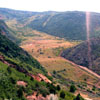
Physical Locations: Oxbow lakes may exist wherever the proper conditions occur. Look for oxbow lakes on wide flat plains with a source of flowing water. The Mississippi River and the Amazon River both have numerous oxbow bends, oxbow lakes and meander scars. Melting glacier water, as well as tropical rivers, can both be sources of meandering rivers, therefore oxbow lakes can be found worldwide.
Access difficulty: Depends on the location and accessibility. Since oxbow lakes form on flat plains, this landform may be easier to access then most.
Natural Decay/Destruction: In comparison to many landforms, lakes have short life-spans, as any depression in the earth is destined to be filled in by sediments and deposits from upstream, as well as from organic material growing along it’s shores. A lake may exist for a few hundred years or even a few thousand years but this represents mere moments in geologic time.
Effect on environment: The still, freshwater in an oxbow lake creates a significant aquatic habitat for wetland and marshland. Tadpoles and young frogs, fish, young turtles, some types of snails and certain aquatic plants favor a setting with calmer waters than a moving river can provide.
Oxbow lakes may behave similar to wetlands in that they act as a sponge for retaining water that is dispersed slowly during dry seasons, thereby providing water to plants and animals at a time when other sources have dried up. Oxbow lakes also capture floodwaters during rainy season, slowing the land erosion and property destruction of an overflowing river.
Effect on humans: Having assumed that a rivers path was permanent, civilizations have been built along meandering rivers, only to have their buildings and farms washed away as the river wandered across it’s flat, sediment plain.


